Reconciling City Planning Best Practices with Space Settlements: Designing for Cost Optimization, Efficiency, and Productivity

A survey of space settlement construction literature indicates that primary factors driving design are cost and technology development, not physical or material design constraints.

This is good news for space settlements: reconciling engineering constraints and city planning best practices is a matter of optimizing settlement planning and design practices to best meet space settlement needs. Cost-optimized design is apparent through the necessary robotic nature of lunar operations (RLSO 1 & 2).

A space business park model is recommended by Sherwood (2016), which coincides with the scale of forthcoming heavy-lift rockets. City planning best practices can significantly increase ROI of space settlements at this scale.

As a research fellow with the Open Lunar Foundation, I have published research on lunar zoning (see post below), one facet of city planning. City planning best practices must be fully reconciled with the constraints of space settlements. The following are a broad set of research topics that must be fully explored to provide optimal recommendations for space settlement planning:

  • Determine materials and construction technology that best allow alignment of city planning best practices and desired outcomes of facilities and activities;

  • Specify urban design standards through a form-based code to guide development toward a mixed-use, dense development pattern on an orthogonal grid;

  • Right-size infrastructure and facilities to efficiently integrate habitats, activities, robotics;

  • Apply urban economics to manage externalities, analyze and prioritize land use and transportation, and facilitate public-private partnerships and enterprise specialization;

  • Combine city planning best practices with existing space industry recommendations such as NASA Man-Systems Integration Standards (NASA MSIS);

  • Refine a set of analytical methods including GIS, parametric modeling, and other city planning analytical tools to triangulate data with other research.

  • Apply lessons learned from Antarctica and other extreme settlements (Pitfalls of Remote, Extreme Settlements);

  • Inform resource allocation and demographic analysis for long-term settlements; and,

  • Develop recommendations for administrative capacity for coupling plans, designs, and capital budgets, and implementing them successfully (demonstrated with McMurdo Station, Antarctica Augustine, et. al. 2012).

These are broad topics I hope to fully explore in the coming years. The future of space exploration is exciting; I hope to contribute to the success of future space settlements!

Lunar Zoning: A Pragmatic Exploration of Zoning Options for the Moon

Thank you to the Open Lunar Foundation for hosting and supporting my paper through their fellowship program! It was thrilling to contribute a city planning perspective to the discussion, and I could not have done it without the generous support of the wonderful people both leading the organization, and those involved in the Open Lunar network. My sincerest thanks!

Through this fellowship, I was able to explore zoning methods and policy within the legal and physical context of the Moon. Engaging with space lawyers and the Outer Space Treaty was eye-opening; the fundamental legal principles of space exploration are distinct from that we typically experience on Earth. I reconciled zoning with this legal context, and produced a comprehensive set of recommendations for deploying zoning and land use policies for the Moon. The lunar built environment will be more efficient and productive with these zoning tools.

This model demonstrates the measurable impact of mixed-use zoning, and especially density, on trip distances. The immediate tendency may be to separate uses for space settlements, but this would incur sizeable trip distance increases. Trip distances…

This model demonstrates the measurable impact of mixed-use zoning, and especially density, on trip distances. The immediate tendency may be to separate uses for space settlements, but this would incur sizeable trip distance increases. Trip distances dramatically decrease when land uses are allowed to coexist, and when several floors are introduced to lots as shown in the final stage. City planning best practices should followed where possible; only when engineering constraints require it should best practices be abridged.

Identifying Low-Performing Bus Routes and High Poverty Density in New York City

This project used MTA Bus Time data to analyze bus route speed of the entire bus system and couple those findings with census data of poverty density. This method could be utilized to identify areas where bus route performance is low for individuals that may depend on buses the most.

On any given, day, over five thousand buses are in service in NYC. For three months in the fall of 2014, every data point of each bus location and distance along its route was recorded. This dataset was composed of over five million data points. I used Python to determine the average speed of each route based on each unique route completion by every vehicle in the fleet over a 24 hour period on Tuesday, 08/05/2014. Then, I joined these average speeds to the MTA Bus Route Shapefile found here at the Newman Library.

These route speed values were then to census tracts with poverty density values, and I created a composite score ranging from high speed buses and low poverty density to low speed buses and high poverty density. The M4, M3, M101, Q66, and BX1 were routes that consistently served higher poverty density areas, and maintained the lowest average speed.

AvgRouteSpeed.png
FinalMap1+%5BConverted%5D.jpg

Sample Python Code

data0.loc[data0.distance_along_trip < 100] = data0.loc[data0.distance_along_trip<100].drop_duplicates (subset = ['distance_along_trip', 'inferred_trip_id'], keep = 'last')
data0.loc[data0.distance_along_trip > 100] = data0.loc[data0.distance_along_trip > 100].drop_duplicates(subset = ['distance_along_trip', 'inferred_trip_id'], keep = 'first')
tripDistance = data1.groupby('inferred_trip_id').distance_along_trip.max()
td = pd.DataFrame(tripDistance)
td["tid"] = td.index
import re
a = "MTA NYCT_B44+"
r = r'^.*_([^_]*)$'
a = re.sub(r, '\g<1>', a)
data10['inferred_route_id'] = data10['inferred_route_id'].str.replace(r'^.*_([^_]*)$', '\g<1>')
RoutesSelection [Converted].png

Proposed Reconfiguration of Housing at McMurdo Station, Antarctica

Master plans continuously call for reconfiguring McMurdo Station, consolidating buildings and improving energy and operational efficiency. This analysis was conducted in Rhino and Grasshopper; 1028 iterations of the station were conducted to identify leading designs. Significant savings in station footprint and improvements in daylighting and views were realized, all of which are identified as beneficial for station occupants.

McMurdo Station Webcam.gif
Capture2.JPG
Capture.JPG
mcspanko buildings.PNG
Reconfiguration_FinalGif3.gif
McMurod Final Project.png

While the average area to perimeter ratio of McMurdo buildings rose slowly over its lifetime, the station operations far outpaced the capital investment and development of McMurdo. The result: a sprawling station suffering from many inefficient, poorly-maintained, and outdated structures. This reconfiguration would allow for an incremental step in the direction of consolidation and improving station facilities.

3.JPG

Transit Oriented Redevelopment: To Kwa Wan, Hong Kong

This studio is concerned with addressing the challenges facing the To Kwa Wan community, namely housing cost inflation, resident displacement, and an aging built environment. Urban renewal in Hong Kong resonates with urban renewal in the United States in the mid 1900s: residents are forced out of their community due to development by the public sector. Major investments in the built environment, combined with inclusionary housing programs and a robust stakeholder network were proposed to combat these ongoing issues.

Executive+summary+figures.jpg
The new MTR station combined with redevelopment in this area is resulting in displacement of current residents and higher housing costs from new demand.

The new MTR station combined with redevelopment in this area is resulting in displacement of current residents and higher housing costs from new demand.

Indicators of vulnerable demographics.

Indicators of vulnerable demographics.

cantonese speaking.PNG
Proposed inclusionary housing and industry zoning for To Kwa Wan to reduce displacement.

Proposed inclusionary housing and industry zoning for To Kwa Wan to reduce displacement.

ped priority.PNG
network.PNG
timeline.PNG

Identifying Low Voter Turnout and High Commute Times in Ohio

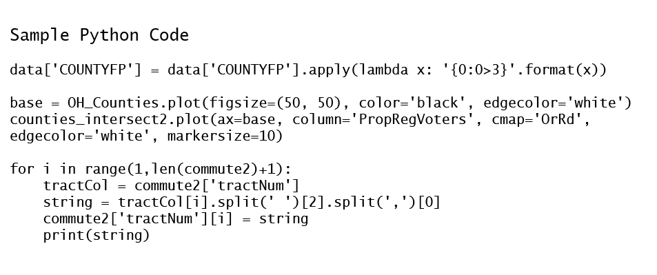
Using Python, ACS data and the Ohio voter file from NationBuilder, I identified a marginally-won state congressional district in Ohio and analyzed it for voter turnout and commute times. This methodology is a proof-of-concept that political campaigns can target districts with certain issues, in this case high average commutes, for campaigning. At the same time, they can spend campaign resources in areas with low turnout, reaching discouraged voters or individuals not accustomed to direct acknowledgement of their issues.

a.png
c.png
voter turout2.png
sample code.PNG

Houston, TX, Wetland Loss Prior to Hurricane Harvey

Scientists estimate significant loss of wetland habitat upwards of 30% in some portions of Houston, Texas. While these wetlands would not have prevented the destruction of Hurricane Harvey, there presence would have softened the blow, analogous to the effect of mangrove habitat loss prior to the 2004 tsunami. This landsat classification and subsequent raster calculation estimates a 33% loss of wetland habitat for the northwest portion of Houston from 1987 to 2017.

Capture1.PNG
Capture.PNG